ID 437962 | MPN COLUMBIAL
Fish N Map
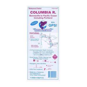
Fish N Map Columbia River Lower

Save up to $50 on your online order today!
Advertised prices may display a strikethrough or regular price. The strikethrough or regular price represents either 1) the manufacturer’s Minimum Advertised Price (MAP) OR the Manufacturer’s Suggested Retail Price (MSRP) or 2) a price at which the product was offered within the last 90 days.
437962
Overview
Fish N Map Columbia River, Lower -Fish-n-Map Company's GPS coordinates are attached to various structural elements which have the potential of holding fish - depending on the season, water elevation, etc. These GPS coordinates are available in gpx format for downloading into chart plotters, fish finders and hand held devices. See "Columbia River, Lower - gpx formatted gps coordinates" if interested.
- Contours: 10'
- Scale: 1:55,550
- GPS Data: Yes
- Water Type: Fresh
- Bonneville Dam to Pacific Ocean, including Portland, Oregon
Specifications
| Model | COLUMBIAL |
|---|
Reviews
Notify Me When In Stock
You are tracking this product.
You have removed this product alert
Thank You,
An error occurred processing your request. Please try again later.
Please enter a valid email


CUSTOMER GALLERY