ID 702325 | MPN 112
National Geographic
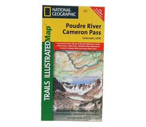
National Geographic Poudre River Cameron Pass Trail Map Colorado


Save up to $50 on your online order today!
Advertised prices may display a strikethrough or regular price. The strikethrough or regular price represents either 1) the manufacturer’s Minimum Advertised Price (MAP) OR the Manufacturer’s Suggested Retail Price (MSRP) or 2) a price at which the product was offered within the last 90 days.
702325

National Geographic Poudre River Cameron Pass Trail Map Colorado
by National Geographic
$4.92
Overview
National Geographic Poudre River Cameron Pass Trail Map Colorado - The Poudre River/Cameron Pass Trails Illustrated map is the most comprehensive recreational map for this beautiful area surrounding the northern portion of Rocky Mountain National Park in Colorado. Coverage includes: Arapaho and Roosevelt national forests; Pingree Park; the Rawah; Commanche Peak; Neota wilderness areas; Cameron, Montgomery and Grassy passes; the Colorado State Forest; the cities of Indian Meadows, Spencer Heights and Glen Echo; Chambers Lake; Cache La Poudre and Laramie rivers; Comanche and Joe Wright reservoirs
- Folded Size: 4.25"x9.25"
- Fully Open Size: 25.5"x37.75"
- Scale: 1:40,680
- Map Revised: 2003
Specifications
| Model | 112 |
|---|
Reviews
Notify Me When In Stock
You are tracking this product.
You have removed this product alert
Thank You,
An error occurred processing your request. Please try again later.
Please enter a valid email


CUSTOMER GALLERY