ID 707089 | MPN 202
National Geographic
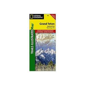
National Geographic Grand Teton National Park Trail Map Wyoming


$4.92
National Geographic Grand Teton National Park Trail Map Wyoming - More than just a map, National Geographic Trails Illustrated topographic maps are designed to take you into the wilderness and back. Printed on tear-resistant, waterproof material, this map can go anywhere you do.
Save up to $50 on your online order today!
Added to Your Cart
Advertised prices may display a strikethrough or regular price. The strikethrough or regular price represents either 1) the manufacturer’s Minimum Advertised Price (MAP) OR the Manufacturer’s Suggested Retail Price (MSRP) or 2) a price at which the product was offered within the last 90 days.
707089

National Geographic Grand Teton National Park Trail Map Wyoming
by National Geographic
$4.92
Overview
National Geographic Grand Teton National Park Trail Map Wyoming - This Trails Illustrated topographic map is the most comprehensive recreational map for Wyoming's Grand Teton National Park. Coverage includes Fort Meade Recreation Area, Black Hills Experimental Forest, Bridger Teton National Forest, Caribou Targhee National Forest, Deerfield Lake, Jedediah Smith and Gros Ventre Wilderness areas, John D. Rockefeller Jr. Memorial Parkway, Colter Bay Village, Sturgis and Jackson, Snow King Mountain, Jackson Hole Mountain Resort, and Grand Targhee Resort. Also includes UTM grids for use with your GPS unit.
- Folded Size: 4.25"x9.25"
- Fully Open Size: 25.5"x37.75"
- Scale: 1:80,000
- Map Revised: 2008
Specifications
| Model | 202 |
|---|
Reviews
Notify Me When In Stock
You are tracking this product.
You have removed this product alert
Thank You,
An error occurred processing your request. Please try again later.
Please enter a valid email


CUSTOMER GALLERY